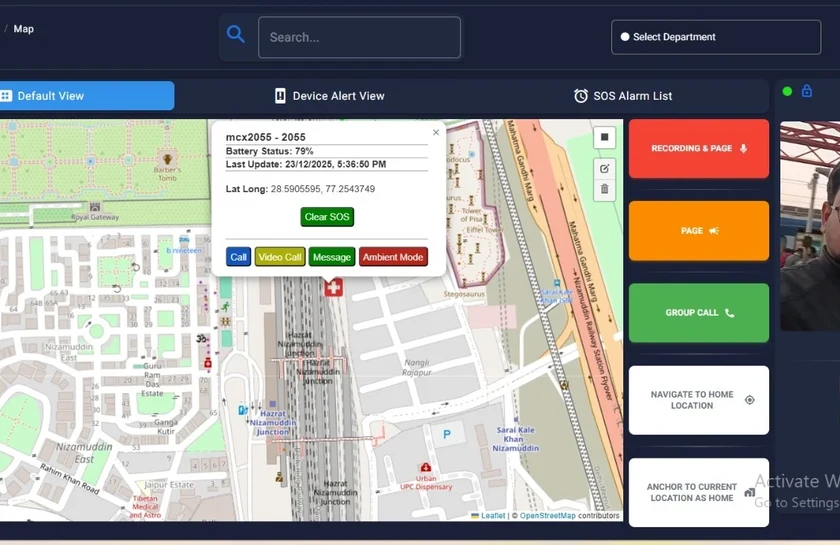
Coral Dispatcher Console
See field locations and manage calls directly from the map.
Public safety & defence
See field resources on a map and manage group calls, private communication and incident coordination from one workspace.
A dispatcher needs to understand where resources are and reach the right team quickly. Coral’s dispatcher console combines geospatial resource visibility with the configured voice, video and messaging functions of the Coral communications platform.
Location information supports resource selection, geofencing and incident coordination. The interface supports map-based interaction and configurable operator layouts. Touch operation and multiple monitors are options within the selected workstation design.
Operators can manage group PTT and private calls, with selected mobile, IP-phone and legacy-radio interfaces brought into the deployment. Incident logging, alerts, escalation and recording support follow-up and review where configured.
Specify operator roles, geographic zones, talk groups, escalation rules and recording retention. Agree the location-update behaviour, available map data and how the console should behave if an external service or backhaul path is lost.
No. The same platform approach is applicable to railway, defence, industrial and emergency-response operations, with workflows configured for the organisation.
Selected legacy radio systems can be integrated through supported gateways. Available controls and status information depend on the radio interface and the agreed integration.
Contact Anil Nagpal for solution planning, catalogue information and deployment requirements.
Enquire about this solution